Plant Me Here
Because healthy landscapes start with informed decisions.

Problem Statement
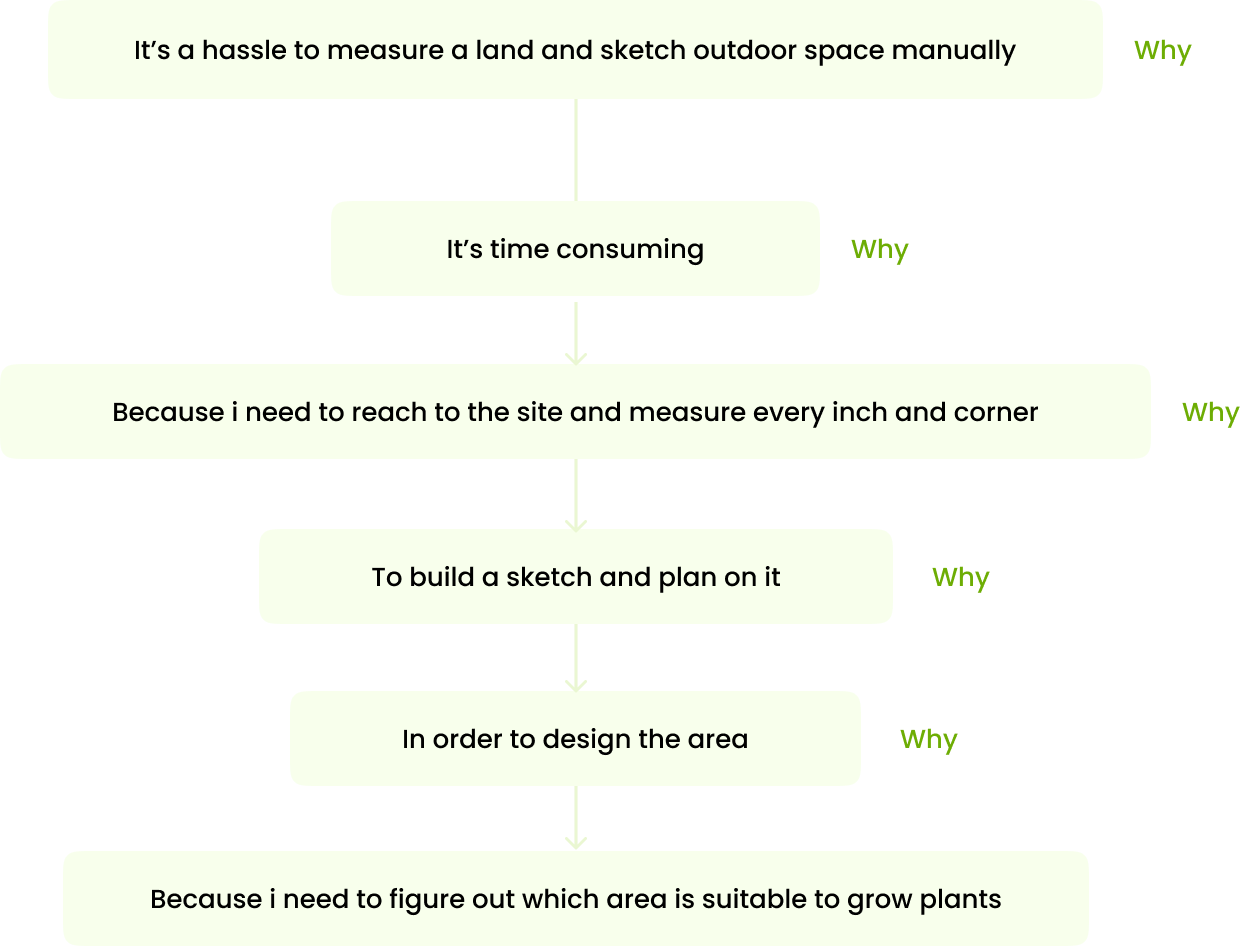
Landscape architects face hurdles in their workflow and client communication due to limitations in existing tools. Manually measuring sites is time-consuming, plant recommendations often lack site-specific accuracy, and showcasing their expertise in sustainability can be challenging. This leads to missed project opportunities and undervaluing of their design skills.
Problem Solution
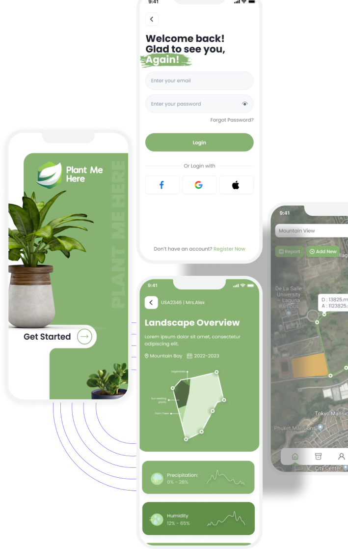
Plant me Here tackles these challenges by offering a comprehensive platform designed specifically for working professionals in the field. We aim to achieve this through:
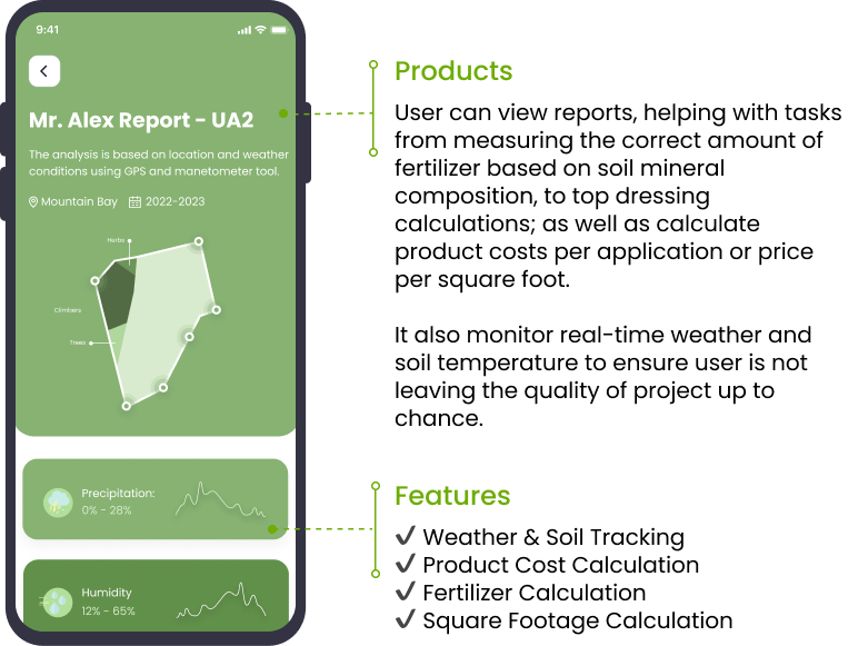
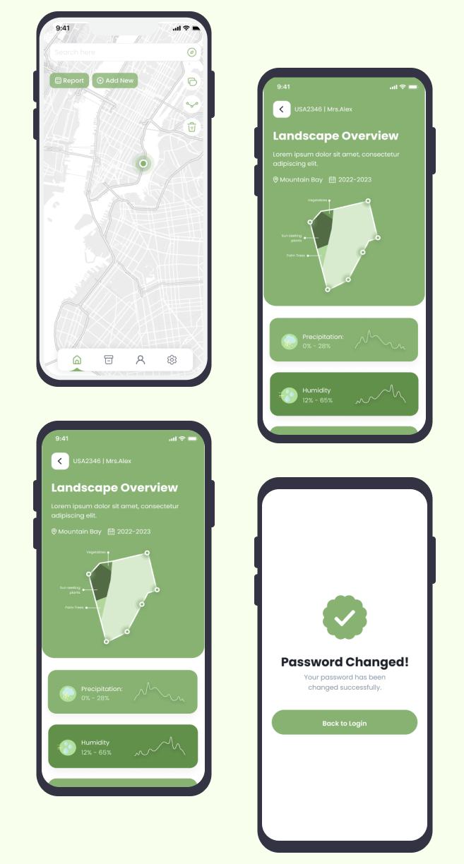
Streamlined Site Analysis: Eliminate manual calculations with intuitive area and distance measurement tools using maps, GPS, and drawing functions. Improve project planning and cost estimations with accurate site data at your fingertips.
Data-Driven Plant Selection: Integrate comprehensive sunlight data and plant knowledge to recommend suitable options for each unique site. Ensure high plant survival rates and enhance client satisfaction with informed choices.
Sustainability Advocacy and Design Storytelling: Equip Landscape Architects with features to showcase their expertise in sustainable design solutions. Effectively communicate the value they bring to projects and secure lead positions in this crucial area.
Target Audience
Outdoor Landscape Architects & Designers
- Specifically professionals
- Ages of 25 and 55


The Approach
As a UX designer, I’d immerse myself in Landscape Architects’ world: interviewing, analyzing, and understanding their struggles. Building empathy guides design: intuitive site analysis, data-driven plant picks, and sustainability spotlights. Each step involves rapid prototyping, testing, and iterating with real users to ensure an efficient, empowering Plant me Here.
My Role
Design Thinking Process
Our user-centered approach starts with immersing ourselves in landscape architects’ shoes, understanding their struggles and dreams. We’ll translate those insights into a clear problem statement: how to empower them with accessible tools. Brainstorming creative solutions, we’ll rapidly build and test prototypes, refining them based on real user feedback.

Emphatize
- User Research
- User Interview
- Entrant Analysis

Define
- User Persona
- User Jouney Map
- Goal Statement
- Empathy Map

Ideate
- Brainstorming
- Card Sorting
- User Flow

Design
- Paper Wireframes
- Visual Design
- Prototype

Test
- Check Usability
- Survey Insight
- Improvements
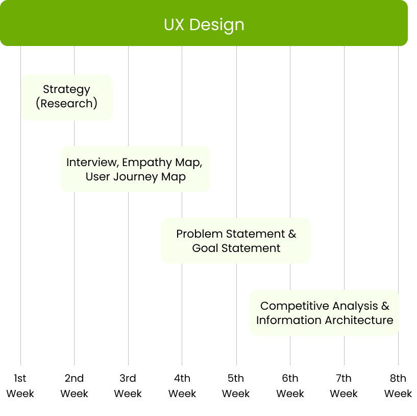
Project Timeline
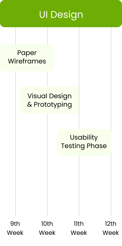
Emphatize Phase
Qualitative Research
During Qualitative Research we focused on understanding the depth and nuances of human experiences, perceptions, and behaviors through methods like interviews, observations, and open-ended surveys. It provides rich, context-specific insights, allowing researchers to explore complex phenomena and generate in-depth understanding, often used to explore new topics and generate hypotheses.
Interview Questions
- What are your current methods for measuring & analyzing project sites? What challenges do you face?
- How do you currently choose plants for specific lighting conditions? Are there any frustrations with this process?
- How do you communicate your design expertise & value, especially regarding sustainability? What challenges arise?
- What software or tools do you currently use for your work? What are their limitations?
- What aspects of your workflow could be made more efficient? How would that impact your business?
Key Insight Derived
- Landscape architects lack efficient tools for site analysis & plant selection, hindering workflow & project success.
- Uncertainty in plant selection due to limited tools impacts client satisfaction & project outcomes.
- Communicating design expertise & value, especially regarding sustainability, poses a challenge for many landscape architects.
- Landscape architects value efficiency, accurate plant selection, improved client communication, and recognition as sustainable design leaders.
Quantitative Research
During Quantitative research employs statistical methods to collect and analyze numerical data, aiming for objective and generalizable conclusions, often gathered through surveys, experiments, or structured observations. It emphasizes measurement, numerical analysis, and statistical modeling to identify patterns and relationships.
To what extent do you agree that current tools for measuring and analyzing project sites are efficient and user-friendly?


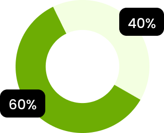
How much do you agree that uncertainty in plant selection due to limited tools negatively impacts your project success and client satisfaction?


Do you agree that communicating your design expertise and value, especially regarding sustainability, is easy and effective with your current tools and processes?


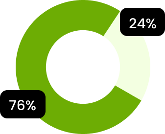
How much would you benefit from a user-friendly platform that streamlines site analysis, provides data-driven plant recommendations, and helps showcase your sustainable design expertise?


On a scale of 1-5, how likely are you to adopt a new tool that addresses your current challenges and streamlines your workflow?


Key Insight Derived
- Key Insight Derived Analyzing responses to question 1 will reveal the prevalence of frustration with existing site analysis tools and the need for efficiency.
- Question 2 gauges the impact of plant selection uncertainty on project outcomes and client satisfaction, highlighting the need for accurate recommendations.
- Responses to question 3 identify the difficulty of communicating design value and the potential demand for better tools for showcasing expertise, particularly in sustainability.
- Question 4 assesses the overall interest and perceived value of a platform like Ever Green that addresses their key concerns.
- Finally, question 5 predicts the potential adoption rate and user base for your platform, indicating its viability and market fit.
Competitor Analysis
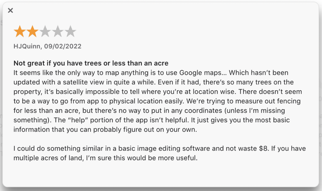
Planimeter
This GPS tool uses a satellite map to make quick site measurements, including perimeters, distances, bearings or angles in imperial or metric units.
Features :
- Magnifying glass function for pin placement.
- Add labels to your maps



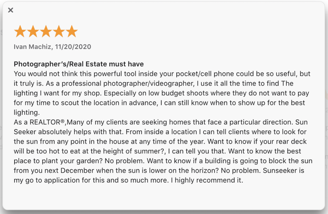
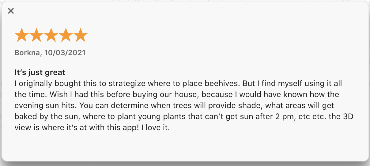
Sunseeker
Sunseeker uses GPS and magnetometer data to show the sun’s path at a given location on both a flat compass view and as a realistic camera view.
Features :
- Position of the sun in hourly increments
- Sun's path on any date, summer and winter solstice paths and sunrise and sunset time
Define Phase
User Persona
Lorem ipsum dolor sit amet, consectetur adipiscing elit, sed do eiusmod tempor incididunt ut labore et dolore magna aliqua. Ut enim ad minim veniam, quis nostrud exercitation ullamco laboris nisi ut aliquip ex ea commodo consequat.

Maya
| Age | 32 |
| Education | MA. Landscape Arch |
| Status | Married, no children |
| Occupation | Landscape Architect |
| Location | Seattle, Washington |
Personality
Breif Story
Maya after five years, she's moved to a mid-sized firm with more resources and diverse projects. While she loves the creative aspect of her job, she often finds herself bogged down by inefficient tools and processes. Manual site measurements take valuable time, plant selection can be a guessing game, and showcasing her firm's sustainable design expertise to clients proves challenging.
Goals
- Increase her efficiency in site measurement & analysis to meet tight deadlines and budgets.
- Confidently recommend plants that will thrive in specific site conditions, ensuring happy clients and project success.
Frustations
- Repetitive and time-consuming manual site measurements.
- Limited access to accurate plant data based on specific site conditions.
- Difficulty in translating complex design concepts and sustainability benefits into client-friendly terms.
Needs
- Efficiency: Maya needs tools that streamline site measurement and analysis, saving her time and allowing her to meet tight deadlines and budgets.
- Accuracy: Plant selection is crucial, and Maya requires a solution that offers data-driven plant recommendations based on specific site conditions, guaranteeing high plant survival rates and project success.
Motivations
- Passion: Maya is passionate about landscape architecture and wants to create beautiful, functional spaces that positively impact the environment.
- Recognition: She desires to be recognized as a leader in sustainable design and establish her firm as a top player in the industry.
Empathy Map
Says
- "I spend too much time manually measuring sites, it's inefficient and takes away from design time."
- "I wish there were tools that could make my job easier and help me win more projects."
Thinks
- "How can I be more efficient with my time without sacrificing quality?"
- "What if I choose the wrong plant and the project fails? That would be embarrassing."

Does
- Researches new tools and resources online.
- Networks with other landscape architects to learn best practices.
- Spends extra time double-checking her work to avoid errors.
Feels
- Frustrated with inefficient tools and processes.
- Anxious about making mistakes and disappointing clients.
- Undervalued compared to other design professionals.
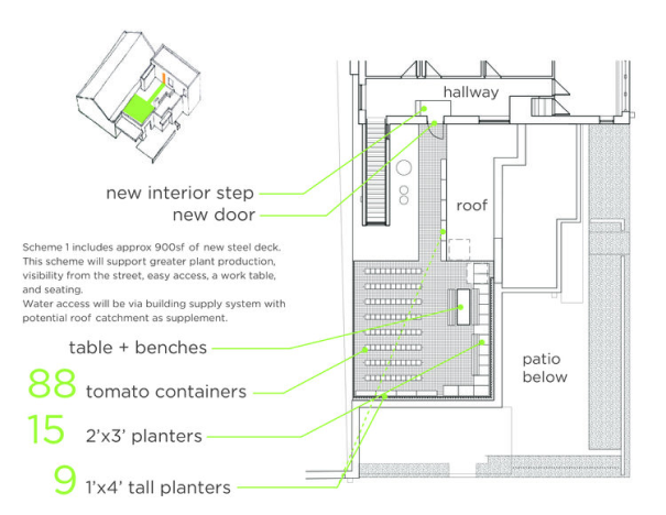
Maya’s Work Example

Card Sorting
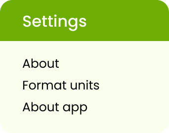
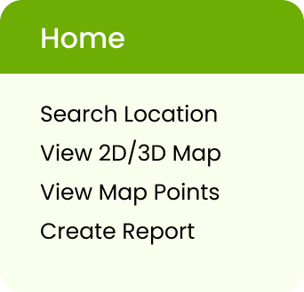


Value It Provides To Climate
In order to effectively handle the effects of climate change, landscape architects must select appropriate plant catalogs, plant them carefully, and take into account the site’s existing characteristics. However, landscape architects continue to demonstrate that this is frequently untrue. Returning to the most fundamental existent system — the land — in search of solutions to our contemporary problems offers a method that frees us from dependence on the byproducts of industry and extraction. It is one that promises to not only deal with the current issue but also assist in transforming our towns into resilient, prosperous places by planting grasses, flowers, ferns, shrubs, and trees therein.

Next Steps
The project is still a work in progress. I am planning to conduct more preference tests since click tests are quick and always great for speeding up the decision-making process with very little investment. On top of that, if this weren’t a student project, I would have run various further A/B tests once the product hit the market.
This app can be expanded in terms of some new features in the future:
• Create more customized reports based on location and climate.
• Visualize a 3d version of your garden.
• It recommends plants with detailed information like their benefits,
looks, and substitutes.
• Recommend planting areas and plants based on the client’s allergy to
plants.
Significance Of a Product Vs Prior Art
To cater to this problem there are some existing apps like sunseeker, planimeter, and garden plan pro, which are mostly focused on landscape design, not on architecture. The currently available applications assist you in plant identification and offer guidance on how to care for hundreds of flowers and plants. You can use it to share knowledge, follow other gardeners, and create your growing calendar. However, plant me here assists landscape architects in producing project reports for their clients and making suggestions for which plants to grow and where to place them. It not only recommends which plants to grow but also identifies the best place for each plant. It greatly benefits the landscape architect.
High-Fidelity Wireframes

Typography & Colors
Font Used

Satoshi font is a elegant and modern sans serif font. It is very neat and clean. It have more readability and variety of options. That’s why I used this font.

Color Used




Coding
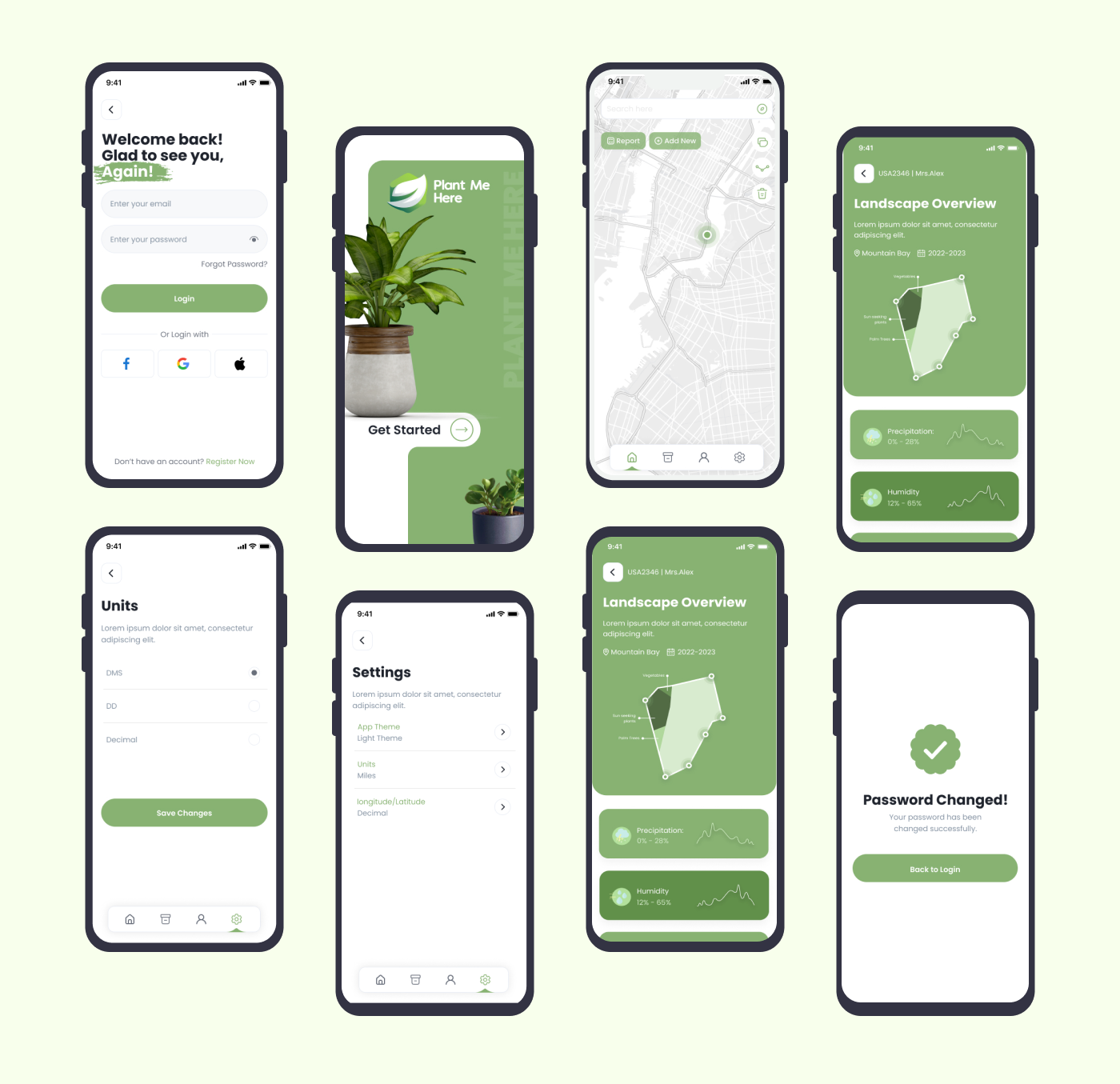
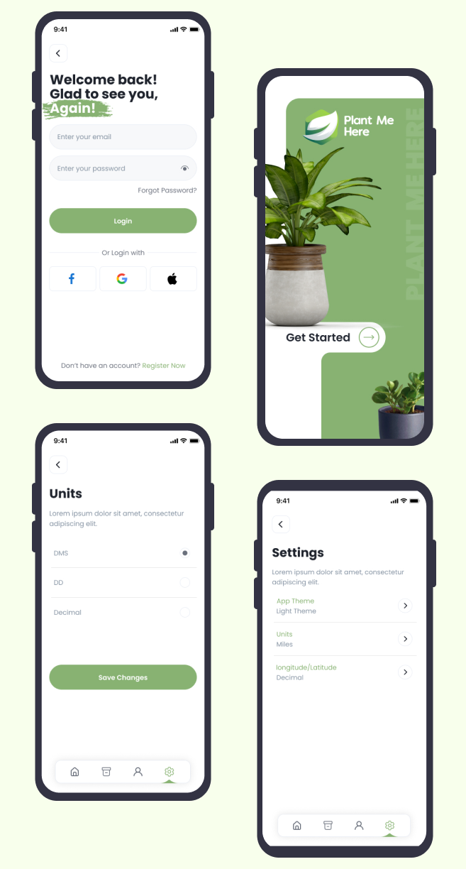
After desiging high fidelity prototypes of an app, i developed/coded the screens into p5 Javascript language, to make it interactive.

Thank you for your time 🙂
Feel free to provide your valuable suggestion and comments
